
姚家庄镇 topographic map
Interactive map
Click on the map to display elevation.
About this map
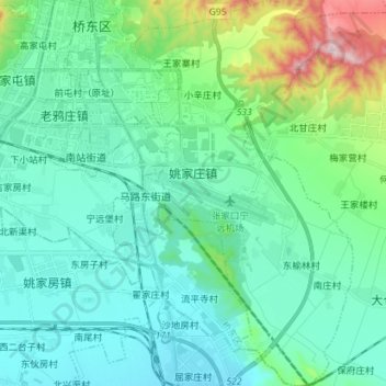
Name: 姚家庄镇 topographic map, elevation, terrain.
Location: 姚家庄镇, 桥东区, 张家口市, 河北省, 075000, 中国 (40.68661 114.90293 40.79392 114.98381)
Average elevation: 749 m
Minimum elevation: 646 m
Maximum elevation: 1,194 m
Other topographic maps
Click on a map to view its topography, its elevation and its terrain.