
桥西区 topographic map
Interactive map
Click on the map to display elevation.
About this map
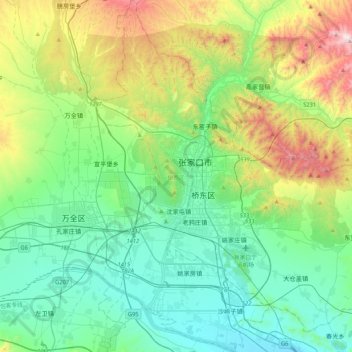
Name: 桥西区 topographic map, elevation, terrain.
Location: 桥西区, 张家口市, 河北省, 075000, 中国 (40.64334 114.75792 40.96408 114.96722)
Average elevation: 917 m
Minimum elevation: 618 m
Maximum elevation: 1,764 m
Other topographic maps
Click on a map to view its topography, its elevation and its terrain.