
怀来县 topographic map
Interactive map
Click on the map to display elevation.
About this map
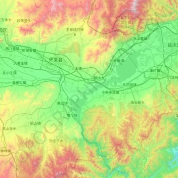
Name: 怀来县 topographic map, elevation, terrain.
Location: 怀来县, 张家口市, 河北省, 中国 (40.06413 115.27853 40.58777 115.96294)
Average elevation: 840 m
Minimum elevation: 234 m
Maximum elevation: 2,218 m
Other topographic maps
Click on a map to view its topography, its elevation and its terrain.