
United States topographic map
Interactive map
Click on the map to display elevation.
About this map
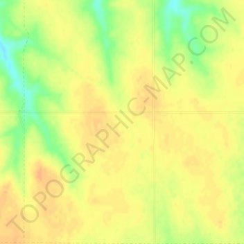
Name: United States topographic map, elevation, terrain.
Location: United States (-14.76084 -180.00000 71.58895 180.00000)
Average elevation: 309 m
Minimum elevation: -29 m
Maximum elevation: 5,001 m
The Rocky Mountains, west of the Great Plains, extend north to south across the country, peaking at over 14,000 feet (4,300 m) in Colorado. Farther west are the rocky Great Basin and deserts such as the Chihuahua, Sonoran, and Mojave. The Sierra Nevada and Cascade mountain ranges run close to the Pacific coast, both ranges also reaching altitudes higher than 14,000 feet (4,300 m). The lowest and highest points in the contiguous United States are in the state of California, and only about 84 miles (135 km) apart. At an elevation of 20,310 feet (6,190.5 m), Alaska's Denali is the highest peak in the country and in North America. Active volcanoes are common throughout Alaska's Alexander and Aleutian Islands, and Hawaii consists of volcanic islands. The supervolcano underlying Yellowstone National Park in the Rockies is the continent's largest volcanic feature.
Other topographic maps
Click on a map to view its topography, its elevation and its terrain.
Yangshuo County
Yangshuo County, Guilin, Guangxi, China
Average elevation: 319 m
Chiang Mai
Thailand > Chiang Mai Province
Chiang Mai, Pa Daet, Saraphi District, Chiang Mai Province, 55520, Thailand
Average elevation: 424 m
Okinawa Prefecture
Japan > Kyushu Region > Nago
Okinawa Prefecture, 県道18号, Nago, Okinawa Prefecture, Kyushu Region, 905-2266, Japan
Average elevation: 139 m
Schladming
Austria > Styria > Bezirk Liezen
Schladming, Politische Expositur Gröbming, Bezirk Liezen, Styria, 8970, Austria
Average elevation: 1,552 m
Saint-Martin-de-Ré
France > Nouvelle-Aquitaine > Charente-Maritime
Saint-Martin-de-Ré, La Rochelle, Charente-Maritime, Nouvelle-Aquitaine, Metropolitan France, 17410, France
Average elevation: 6 m
Avdiivka
Avdiivka, Avdiivka urban hromada, Pokrovskii Raion, Donetsk Oblast, 86060-86075, Ukraine
Average elevation: 206 m
Upper East Side
USA > New York > New York City
Upper East Side, Manhattan, Manhattan Community Board 8, New York County, New York City, New York, USA
Average elevation: 27 m
Ascain
France > Nouvelle-Aquitaine > Pyrénées-Atlantiques
Ascain, Bayonne, Pyrénées-Atlantiques, Nouvelle-Aquitaine, Metropolitan France, 64310, France
Average elevation: 169 m
Dongguang County
Dongguang County, Cangzhou, Hebei, 061600, China
Average elevation: 14 m
Kuban
Kuban, Bilolutska settlement hromada, Starobilsk Raion, Luhansk Oblast, 92326, Ukraine
Average elevation: 83 m
Dominican Republic
Dominican Republic
Average elevation: 126 m
La Flotte
France > Nouvelle-Aquitaine > Charente-Maritime
La Flotte, La Rochelle, Charente-Maritime, Nouvelle-Aquitaine, Metropolitan France, 17630, France
Average elevation: 7 m
Uruguay
Uruguay
Average elevation: 83 m
Chasiv Yar
Chasiv Yar, Chasiv Yar urban hromada, Bakhmut Raion, Donetsk Oblast, 84551-84556, Ukraine
Average elevation: 213 m
Nam Tin
China > Hong Kong > Islands District > Tai O
Nam Tin, Tai O, Islands District, New Territories, Hong Kong, China
Average elevation: 146 m
Sai Kung District
Sai Kung District, New Territories, Hong Kong, China
Average elevation: 29 m
Nam Tin
Myanmar > Shan State > Mongpauk County
Nam Tin, Mongpauk District, Mongpauk County, East Shan State, Shan State, Wa State, Myanmar
Average elevation: 1,409 m
Bishop's Stortford
United Kingdom > England > Hertfordshire > East Hertfordshire
Bishop's Stortford, East Hertfordshire, Hertfordshire, England, United Kingdom
Average elevation: 83 m
Cheadle
United Kingdom > England > Staffordshire > Staffordshire Moorlands
Cheadle, Staffordshire Moorlands, Staffordshire, England, United Kingdom
Average elevation: 191 m
Sunnyvale
United States > California > Santa Clara County
Sunnyvale, Santa Clara County, California, United States
Average elevation: 24 m
Kalgo
Nigeria > Sokoto State > Sabon Birni
Kalgo, Sabon Birni, Sokoto State, Nigeria
Average elevation: 325 m
Daocheng County
Daocheng County, Kardze, Sichuan, 627700, China
Average elevation: 3,926 m
Quezon City
Quezon City, Eastern Manila District, Metro Manila, Philippines
Average elevation: 39 m
Buôn Ma Thuột
Buôn Ma Thuột, Đắk Lắk Province, Vietnam
Average elevation: 442 m
Buck Lake
Canada > Alberta > County of Wetaskiwin
Buck Lake, County of Wetaskiwin, Alberta, T0C 0T0, Canada
Average elevation: 901 m
Devil Lake
United States > Oregon > Klamath County
Devil Lake, Klamath County, Oregon, United States
Average elevation: 1,474 m
Dầu Tiếng District
Dầu Tiếng District, Bình Dương Province, Vietnam
Average elevation: 31 m
Phú Giáo District
Phú Giáo District, Bình Dương Province, Vietnam
Average elevation: 55 m
Rottenburg am Neckar
Germany > Baden-Württemberg > Landkreis Tübingen
Rottenburg am Neckar, Verwaltungsgemeinschaft Rottenburg am Neckar, Landkreis Tübingen, Baden-Württemberg, 72108, Germany
Average elevation: 414 m
先头梁子
China > Yunnan > Malipo County
先头梁子, Malipo County, Wenshan, Yunnan, China
Average elevation: 1,241 m
Hillsvale
Canada > Nova Scotia > Hants County
Hillsvale, Region of Windsor and West Hants Municipality, Hants County, Nova Scotia, B0N 2A0, Canada
Average elevation: 163 m
Maldives
Maldives
Average elevation: 0 m
Tarkastad
South Africa > Eastern Cape > Chris Hani District Municipality > Tsolwana Local Municipality
Tarkastad, Tsolwana Local Municipality, Chris Hani District Municipality, Eastern Cape, 5370, South Africa
Average elevation: 1,347 m
Aurillac
France > Auvergne-Rhône-Alpes > Cantal
Aurillac, Cantal, Auvergne-Rhône-Alpes, Metropolitan France, 15000, France
Average elevation: 668 m
Botswana
Botswana
Average elevation: 1,078 m