
大村镇 topographic map
Interactive map
Click on the map to display elevation.
About this map
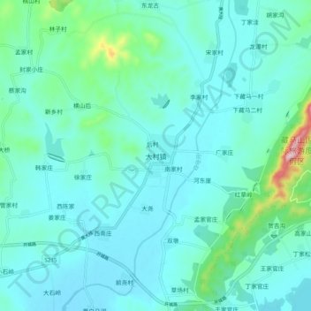
Name: 大村镇 topographic map, elevation, terrain.
Location: 大村镇, 青岛市, 山东省, 中国 (35.76289 119.68078 35.84289 119.76078)
Average elevation: 72 m
Minimum elevation: 22 m
Maximum elevation: 366 m
Other topographic maps
Click on a map to view its topography, its elevation and its terrain.