
青峪 topographic map
Interactive map
Click on the map to display elevation.
About this map
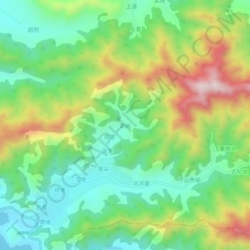
Name: 青峪 topographic map, elevation, terrain.
Location: 青峪, 青岛市, 山东省, 266106, 中国 (36.25348 120.50469 36.29348 120.54469)
Average elevation: 220 m
Minimum elevation: 39 m
Maximum elevation: 535 m
Other topographic maps
Click on a map to view its topography, its elevation and its terrain.