
中山路街道 topographic map
Interactive map
Click on the map to display elevation.
About this map
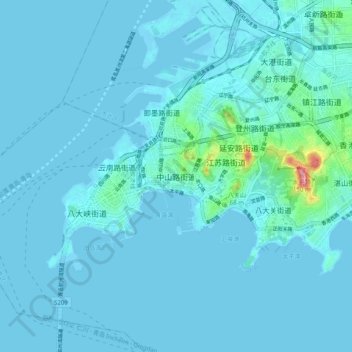
Name: 中山路街道 topographic map, elevation, terrain.
Location: 中山路街道, 青岛市, 山东省, 266001, 中国 (36.02519 120.27789 36.10519 120.35789)
Average elevation: 9 m
Minimum elevation: -2 m
Maximum elevation: 142 m