
红石崖街道 topographic map
Interactive map
Click on the map to display elevation.
About this map
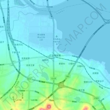
Name: 红石崖街道 topographic map, elevation, terrain.
Location: 红石崖街道, 青岛市, 山东省, 中国 (36.05526 120.06436 36.13526 120.14436)
Average elevation: 17 m
Minimum elevation: -2 m
Maximum elevation: 134 m
Other topographic maps
Click on a map to view its topography, its elevation and its terrain.