
薛家岛街道 topographic map
Interactive map
Click on the map to display elevation.
About this map
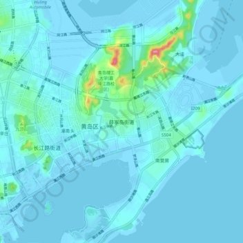
Name: 薛家岛街道 topographic map, elevation, terrain.
Location: 薛家岛街道, 青岛市, 山东省, 266555, 中国 (35.92034 120.16605 36.00034 120.24605)
Average elevation: 10 m
Minimum elevation: -6 m
Maximum elevation: 136 m
Other topographic maps
Click on a map to view its topography, its elevation and its terrain.