
钱江苑社区 topographic map
Interactive map
Click on the map to display elevation.
About this map
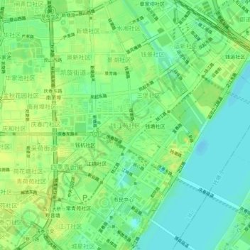
Name: 钱江苑社区 topographic map, elevation, terrain.
Location: 钱江苑社区, 杭州市, 浙江省, 310026, 中国 (30.24143 120.18912 30.28143 120.22912)
Average elevation: 10 m
Minimum elevation: -1 m
Maximum elevation: 19 m
Other topographic maps
Click on a map to view its topography, its elevation and its terrain.