
王朗 topographic map
Interactive map
Click on the map to display elevation.
About this map
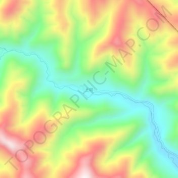
Name: 王朗 topographic map, elevation, terrain.
Location: 王朗, 绵阳市, 四川省, 中国 (32.94962 104.08097 32.98962 104.12097)
Average elevation: 2,849 m
Minimum elevation: 2,523 m
Maximum elevation: 3,255 m
Other topographic maps
Click on a map to view its topography, its elevation and its terrain.