
安州区 topographic map
Interactive map
Click on the map to display elevation.
About this map
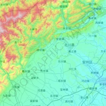
Name: 安州区 topographic map, elevation, terrain.
Location: 安州区, 绵阳市, 四川省, 中国 (31.37180 104.09135 31.79219 104.63654)
Average elevation: 908 m
Minimum elevation: 472 m
Maximum elevation: 2,956 m
Other topographic maps
Click on a map to view its topography, its elevation and its terrain.