
鲁山县 topographic map
Interactive map
Click on the map to display elevation.
About this map
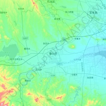
Name: 鲁山县 topographic map, elevation, terrain.
Location: 鲁山县, 平顶山市, 河南省, 中国 (33.58349 112.74834 33.90349 113.06834)
Average elevation: 184 m
Minimum elevation: 101 m
Maximum elevation: 660 m
Other topographic maps
Click on a map to view its topography, its elevation and its terrain.