
鹿邑县 topographic map
Interactive map
Click on the map to display elevation.
About this map
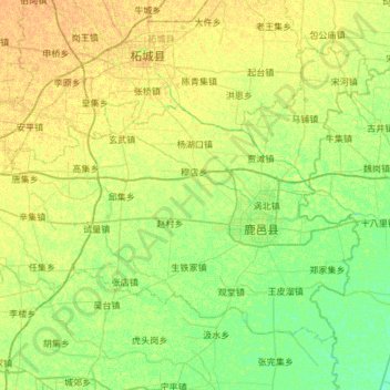
Name: 鹿邑县 topographic map, elevation, terrain.
Location: 鹿邑县, 周口市, 河南省, 中国 (33.71648 115.05688 34.09278 115.65412)
Average elevation: 44 m
Minimum elevation: 35 m
Maximum elevation: 53 m
Other topographic maps
Click on a map to view its topography, its elevation and its terrain.