
色尼区 topographic map
Interactive map
Click on the map to display elevation.
About this map
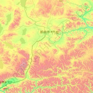
Name: 色尼区 topographic map, elevation, terrain.
Location: 色尼区, 那曲市, 西藏自治区, 中国 (30.51473 90.99093 31.87279 93.01559)
Average elevation: 4,869 m
Minimum elevation: 4,132 m
Maximum elevation: 6,417 m
Other topographic maps
Click on a map to view its topography, its elevation and its terrain.