
申扎镇 topographic map
Interactive map
Click on the map to display elevation.
About this map
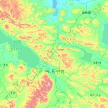
Name: 申扎镇 topographic map, elevation, terrain.
Location: 申扎镇, 申扎县, 那曲市, 西藏自治区, 中国 (30.63747 87.96327 31.48965 88.97906)
Average elevation: 4,947 m
Minimum elevation: 4,562 m
Maximum elevation: 6,367 m
Other topographic maps
Click on a map to view its topography, its elevation and its terrain.