
波罗乡 topographic map
Interactive map
Click on the map to display elevation.
About this map
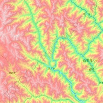
Name: 波罗乡 topographic map, elevation, terrain.
Location: 波罗乡, 江达县, 昌都市, 西藏自治区, 中国 (31.02512 98.29814 31.52452 98.76589)
Average elevation: 4,043 m
Minimum elevation: 2,863 m
Maximum elevation: 5,263 m
Other topographic maps
Click on a map to view its topography, its elevation and its terrain.