
汗牛乡 topographic map
Interactive map
Click on the map to display elevation.
About this map
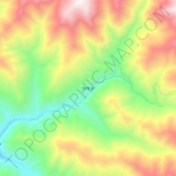
Name: 汗牛乡 topographic map, elevation, terrain.
Location: 汗牛乡, 小金县, 阿坝藏族羌族自治州, 四川省, 中国 (30.74842 102.17306 30.82842 102.25306)
Average elevation: 3,368 m
Minimum elevation: 2,549 m
Maximum elevation: 4,388 m
Other topographic maps
Click on a map to view its topography, its elevation and its terrain.