
川里镇 topographic map
Interactive map
Click on the map to display elevation.
About this map
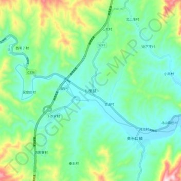
Name: 川里镇 topographic map, elevation, terrain.
Location: 川里镇, 保定市, 河北省, 中国 (39.02817 114.67769 39.10817 114.75769)
Average elevation: 451 m
Minimum elevation: 320 m
Maximum elevation: 821 m
Other topographic maps
Click on a map to view its topography, its elevation and its terrain.