
赵家圈镇 topographic map
Interactive map
Click on the map to display elevation.
About this map
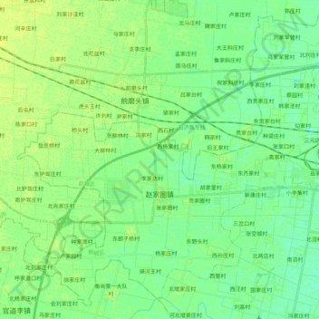
Name: 赵家圈镇 topographic map, elevation, terrain.
Location: 赵家圈镇, 桃城区, 衡水市, 河北省, 053000, 中国 (37.68698 115.42016 37.83156 115.62009)
Average elevation: 26 m
Minimum elevation: 19 m
Maximum elevation: 32 m
Other topographic maps
Click on a map to view its topography, its elevation and its terrain.