
和平区 topographic map
Interactive map
Click on the map to display elevation.
About this map
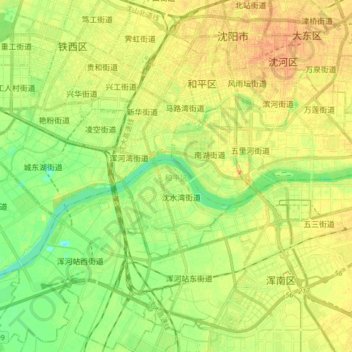
Name: 和平区 topographic map, elevation, terrain.
Location: 和平区, 沈阳市, 辽宁省, 中国 (41.68805 123.31231 41.81514 123.43962)
Average elevation: 46 m
Minimum elevation: 28 m
Maximum elevation: 61 m
Other topographic maps
Click on a map to view its topography, its elevation and its terrain.