
沈北新区 topographic map
Interactive map
Click on the map to display elevation.
About this map
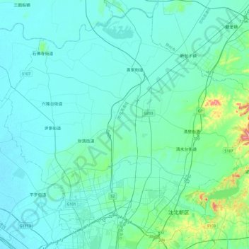
Name: 沈北新区 topographic map, elevation, terrain.
Location: 沈北新区, 沈阳市, 辽宁省, 中国 (41.87623 123.26655 42.19079 123.71875)
Average elevation: 66 m
Minimum elevation: 38 m
Maximum elevation: 307 m
Other topographic maps
Click on a map to view its topography, its elevation and its terrain.