
赠科乡 topographic map
Interactive map
Click on the map to display elevation.
About this map
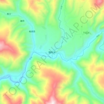
Name: 赠科乡 topographic map, elevation, terrain.
Location: 赠科乡, 白玉县, 甘孜藏族自治州, 四川省, 中国 (31.44282 99.26425 31.52282 99.34425)
Average elevation: 3,622 m
Minimum elevation: 3,225 m
Maximum elevation: 4,413 m
Other topographic maps
Click on a map to view its topography, its elevation and its terrain.