
纳塔乡 topographic map
Interactive map
Click on the map to display elevation.
About this map
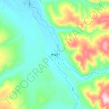
Name: 纳塔乡 topographic map, elevation, terrain.
Location: 纳塔乡, 白玉县, 甘孜藏族自治州, 四川省, 中国 (30.86121 99.58926 30.94121 99.66926)
Average elevation: 4,114 m
Minimum elevation: 3,929 m
Maximum elevation: 4,576 m
Other topographic maps
Click on a map to view its topography, its elevation and its terrain.