
高陵区 topographic map
Interactive map
Click on the map to display elevation.
About this map
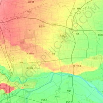
Name: 高陵区 topographic map, elevation, terrain.
Location: 高陵区, 西安市, 陕西省, 710200, 中国 (34.42142 108.95511 34.59490 109.17818)
Average elevation: 382 m
Minimum elevation: 346 m
Maximum elevation: 418 m
Other topographic maps
Click on a map to view its topography, its elevation and its terrain.