
蓝田县 topographic map
Interactive map
Click on the map to display elevation.
About this map
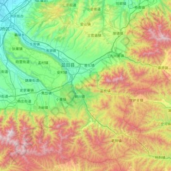
Name: 蓝田县 topographic map, elevation, terrain.
Location: 蓝田县, 西安市, 陕西省, 中国 (33.84122 109.12506 34.33900 109.79144)
Average elevation: 1,107 m
Minimum elevation: 382 m
Maximum elevation: 2,489 m
Other topographic maps
Click on a map to view its topography, its elevation and its terrain.