
阎良区 topographic map
Interactive map
Click on the map to display elevation.
About this map
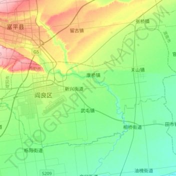
Name: 阎良区 topographic map, elevation, terrain.
Location: 阎良区, 西安市, 陕西省, 710089, 中国 (34.58816 109.15488 34.74595 109.43785)
Average elevation: 390 m
Minimum elevation: 342 m
Maximum elevation: 502 m
Other topographic maps
Click on a map to view its topography, its elevation and its terrain.