
Make a donation
France topographic map
Click on the map to display elevation.
Make a donation
France
Metropolitan France has a wide variety of topographic sets and natural landscapes. During the Hercynian uplift in the Paleozoic Era, the Armorican Massif, the Massif Central, the Morvan, the Vosges and Ardennes ranges and the island of Corsica were formed. These massifs delineate several sedimentary basins such as the Aquitaine Basin in the southwest and the Paris Basin in the north. Various routes of natural passage, such as the Rhône Valley, allow easy communication. The Alpine, Pyrenean and Jura mountains are much younger and have less eroded forms. At 4,810.45 metres (15,782 ft) above sea level, Mont Blanc, located in the Alps on the France–Italy border, is the highest point in Western Europe. Although 60% of municipalities are classified as having seismic risks (though moderate).
Make a donation
About this map
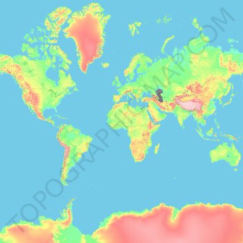
Name: France topographic map, elevation, terrain.
Location: France (-50.21872 -178.38737 51.30557 172.30572)
Average elevation: 430 m
Minimum elevation: -30 m
Maximum elevation: 6,542 m
Make a donation
Other topographic maps
Click on a map to view its topography, its elevation and its terrain.
Istanbul
Istanbul, located in northwestern Turkey, is a city that is uniquely situated across two continents, Europe and Asia, divided by the Bosphorus Strait. The city’s topography is characterized by a complex blend of hills, valleys, and coastal plains, which create a varied and scenic landscape. The European side…
Average elevation: 57 m
Bangladesh
With an elevation of 1,064 m (3,491 ft), Saka Haphong (also known as Mowdok Mual) near the border with Myanmar, is claimed to be the highest peak of Bangladesh. However, it is not yet widely recognized as the highest point of the country, and most sources give the honor to Keokradong.
Average elevation: 1,488 m
Make a donation
Make a donation
Make a donation
Chiang Mai
Chiang Mai has a tropical savanna climate (Köppen Aw), tempered by the low latitude and moderate elevation, with warm to hot weather year-round, though nighttime conditions during the dry season can be cool and much lower than daytime highs. The maximum temperature ever recorded was 42.4 °C (108.3 °F) in…
Average elevation: 424 m
Kastelli
Greece > Region of Crete > Heraklion Regional Unit > Kastelli Municipal Unit
Average elevation: 366 m
Make a donation
Make a donation
Make a donation
Make a donation
Make a donation
Aberlour
United Kingdom > Scotland > Moray
According to the 1846 A Topographical Dictionary of Scotland, "This parish, formerly called Skirdustan, signifying, in the Gaelic tongue, 'the division of Dustan', its tutelary saint, derived its present name from its situation at the mouth of a noisy burn, which discharges itself into the river Spey."
Average elevation: 160 m
Holeta Genet
Ethiopia > Oromia Region > Walmara
Holeta (Amharic: ሆለታ) (Oromo: Holataa) is a town in the special zone of Oromia Region, Ethiopia. It has a latitude and longitude of 9°3′N 38°30′E / 9.050°N 38.500°E / 9.050; 38.500 and an altitude of 2391 meters above sea level.
Average elevation: 2,391 m
Make a donation
Make a donation
Make a donation
Make a donation
Maseru
Maseru is located in northwest Lesotho by the South African border, denoted by the Mohokare River, also known as Caledon River. The two countries are connected by a border post at the Maseru Bridge, which crosses the river. On the South African side, Ladybrand is the town closest to Maseru. The city lies in a…
Average elevation: 1,606 m
Featherston
New Zealand > Wellington > South Wairarapa District > Featherston Community
Average elevation: 125 m
Make a donation
Make a donation
Make a donation
Make a donation
Andes
Andes is a municipality and town in the Antioquia Department, Colombia. Part of the sub-region of Southwestern Antioquia, it is located on the western Colombian Andes mountain range. Andes was founded on 13 March 1852 by Pedro Antonio Restrepo Escobar. Its elevation is 1,360 metres above sea level with an…
Average elevation: 1,559 m
Make a donation
Rangamati
Bangladesh > Chattogram Division > Rangamati Sadar Upazila
Rangamati (Bengali: রাঙামাটি) is a town and the administrative headquarters of Rangamati District in the Chittagong Hill Tracts of Bangladesh. The town is located at 22°37'60N 92°12'0E and has an elevation of 14 metres (46 ft) above sea level.
Average elevation: 68 m
Make a donation
Make a donation
Mount Royal
Canada > Quebec > Urban agglomeration of Montreal > Montreal
The mountain is part of the Monteregian Hills situated between the Laurentians and the Appalachian Mountains. It gave its Latin name, Mons Regius, to the Monteregian chain. The mountain consists of three peaks: Colline de la Croix (or Mont Royal proper) at 233 m (764 ft), Colline d'Outremont (or Mount Murray,…
Average elevation: 111 m
Make a donation
Sarahs
Turkmenistan > Ahal Region > Sarahs District
Sarahs (Turkmen pronunciation: [θɑˈrɑχθ], also written Saraghs, Serahs, Sarakhs, Saragt, or Serakhs, the last a backformation of Russian: Серахс) is an oasis city in Ahal Province, Turkmenistan, and the administrative center of Sarahs district (Turkmen: Sarahs etraby). It is located at latitude…
Average elevation: 279 m
Ankara
Ankara has a cold semi-arid climate (Köppen climate classification: BSk). Under the Trewartha climate classification, Ankara has a temperate humid continental climate (Dc). Due to its elevation and inland location, Ankara has cold and snowy winters, and hot and dry summers. Rainfall occurs mostly during the…
Average elevation: 1,082 m
Make a donation
Hong Kong
Hong Kong has a humid subtropical climate (Köppen Cwa), characteristic of southern China. Summer is hot and humid, with occasional showers and thunderstorms and warm air from the southwest. Typhoons occur most often then, sometimes resulting in floods or landslides. Winters are mild and usually sunny at the…
Average elevation: 62 m
Žabljak
Montenegro > Žabljak Municipality
Žabljak is the seat of Žabljak Municipality (2011 population: 3,569). The town is in the centre of the Durmitor mountain region and with an altitude of 1,456 metres, it is the highest situated Balkan town.
Average elevation: 1,461 m
Make a donation
Make a donation
Make a donation
Phu Kradung
Thailand > Phu Kradueng District
Phu Kradueng National Park (Thai: อุทยานแห่งชาติภูกระดึง), in the Si Than sub-district of Amphoe Phu Kradueng, Loei Province, is a national park in Thailand. It has a high point of 1,316 m (4318 ft) elevation at Khok Moei. It was proclaimed a national park on 23…
Average elevation: 1,183 m
Chattogram
Bangladesh > Chattogram Division > Chittagong City
Chittagong lies at 22°20′06″N 91°49′57″E / 22.33500°N 91.83250°E / 22.33500; 91.83250. It straddles the coastal foothills of the Chittagong Hill Tracts in south-eastern Bangladesh. The Karnaphuli River runs along the southern banks of the city, including its central business district. The…
Average elevation: 6 m
Make a donation