
Thank you for supporting this site ❤️
Make a donation
Make a donation
Jalamehellisi topographic map
Click on the map to display elevation.
Thank you for supporting this site ❤️
Make a donation
Make a donation
About this map
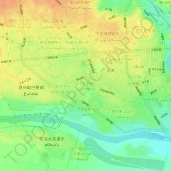
Name: Jalamehellisi topographic map, elevation, terrain.
Location: Jalamehellisi, Kashgar City, Kachgar, Xinjiang, 844000, China (39.43893 75.95422 39.47893 75.99422)
Average elevation: 1,292 m
Minimum elevation: 1,271 m
Maximum elevation: 1,310 m
Thank you for supporting this site ❤️
Make a donation
Make a donation