

Poland topographic maps
Click on a map to view its topography, its elevation and its terrain.
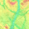
Poznań
Poland > Greater Poland Voivodeship > Poznań County
Poznań covers an area of 261.3 km2 (100.9 sq mi), and has coordinates in the range 52°17'34''–52°30'27''N, 16°44'08''–17°04'28''E. Its highest point, with an altitude of 157 m (515 ft), is the summit of Morasko hill within the Morasko meteorite nature reserve in the north of the city. The lowest…
Average elevation: 85 m


Zamek Książąt Mazowieckich
Poland > Masovian Voivodeship > Piaseczno County > Czersk > Kolonia Czersk
Average elevation: 96 m


Poljańska
Poland > Pomeranian Voivodeship > Kartuzy County > Mojuszewska Huta
Average elevation: 218 m


Ostrów Wielkopolski
Poland > Greater Poland Voivodeship > Ostrów Wielkopolski County > Ostrów Wielkopolski
Average elevation: 140 m


San
The San arises in the Carpathian Mountains near the village of Sianky, at an elevation of 900 metres (3,000 ft), exactly on the Polish-Ukrainian border (49°00′10″N 22°52′30″E / 49.00278°N 22.87500°E / 49.00278; 22.87500) and on the continental watershed, and forms the border between Poland…
Average elevation: 327 m


Wiszniak
Poland > Lower Silesian Voivodeship > Trzebnica County > Piotrkowiczki
Average elevation: 212 m


Kondratova kopa / Kopa Kondracka
Poland > Lesser Poland Voivodeship > Tatra County > Zakopane
Kopa Kondracka (Slovak: Kondratova kopa) is a mountain in the Western Tatras mountain range, situated on the main ridge of the Tatras east of Małołączniak, on the border between Poland and Slovakia. It's the easternmost of the four summits making up the Czerwone Wierchy massif, as well as the lowest, with…
Average elevation: 1,666 m


Parafia Świętego Wojciecha w Stokach
Poland > Lubusz Voivodeship > Międzyrzecz County > Świechocin
Average elevation: 74 m


Białystok
Poland > Podlaskie Voivodeship
The communication system serving the entire city was made of streets radiating out from the central market square. An inventory plan made by Becker in 1799 was needed by the Prussian authorities in connection with the negotiations on the acquisition of Białystok for a royal residence. The plan is of…
Average elevation: 142 m

