
Make a donation
Sarahs topographic map
Click on the map to display elevation.
Make a donation
Sarahs
Sarahs (Turkmen pronunciation: [θɑˈrɑχθ], also written Saraghs, Serahs, Sarakhs, Saragt, or Serakhs, the last a backformation of Russian: Серахс) is an oasis city in Ahal Province, Turkmenistan, and the administrative center of Sarahs district (Turkmen: Sarahs etraby). It is located at latitude 36°31' North; longitude 61°12' East and an elevation of 285m above sea level. It is one of the oases of the ancient Silk Road lying between Merv to the east and Mashhad to the west. In 1989 the city had a population of 9,585.
Make a donation
About this map
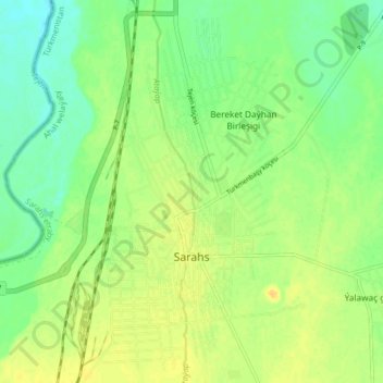
Name: Sarahs topographic map, elevation, terrain.
Location: Sarahs, Sarahs District, Ahal Region, Turkmenistan (36.50219 61.19471 36.56730 61.23338)
Average elevation: 279 m
Minimum elevation: 266 m
Maximum elevation: 291 m
Make a donation