
清镇市 topographic map
Interactive map
Click on the map to display elevation.
About this map
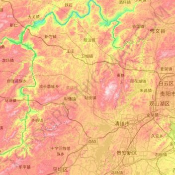
Name: 清镇市 topographic map, elevation, terrain.
Location: 清镇市, 贵阳市, 贵州省, 中国 (26.39990 106.11897 26.93532 106.54756)
Average elevation: 1,287 m
Minimum elevation: 820 m
Maximum elevation: 1,722 m
Other topographic maps
Click on a map to view its topography, its elevation and its terrain.