
孟关乡 topographic map
Interactive map
Click on the map to display elevation.
About this map
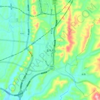
Name: 孟关乡 topographic map, elevation, terrain.
Location: 孟关乡, 贵阳市, 贵州省, 中国 (26.37250 106.70400 26.45250 106.78400)
Average elevation: 1,157 m
Minimum elevation: 1,054 m
Maximum elevation: 1,444 m
Other topographic maps
Click on a map to view its topography, its elevation and its terrain.