
红枫湖 topographic map
Interactive map
Click on the map to display elevation.
About this map
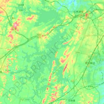
Name: 红枫湖 topographic map, elevation, terrain.
Location: 红枫湖, 贵阳市, 贵州省, 中国 (26.40105 106.32787 26.57179 106.45027)
Average elevation: 1,261 m
Minimum elevation: 1,192 m
Maximum elevation: 1,428 m
Other topographic maps
Click on a map to view its topography, its elevation and its terrain.