
息烽县 topographic map
Interactive map
Click on the map to display elevation.
About this map
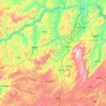
Name: 息烽县 topographic map, elevation, terrain.
Location: 息烽县, 贵阳市, 贵州省, 中国 (26.96729 106.45366 27.32697 106.89290)
Average elevation: 1,115 m
Minimum elevation: 621 m
Maximum elevation: 1,731 m
Other topographic maps
Click on a map to view its topography, its elevation and its terrain.