
曲靖市 topographic map
Interactive map
Click on the map to display elevation.
About this map
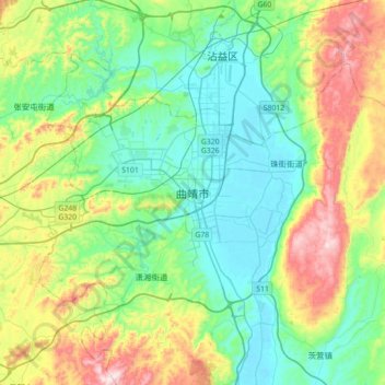
Name: 曲靖市 topographic map, elevation, terrain.
Location: 曲靖市, 麒麟区, 曲靖市, 云南省, 中国 (25.33364 103.63431 25.65364 103.95431)
Average elevation: 2,019 m
Minimum elevation: 1,850 m
Maximum elevation: 2,442 m
全市最高点海拔4017.3米;最低点海拔695米,相对高差3322.3米;平均海拔1881米。
Other topographic maps
Click on a map to view its topography, its elevation and its terrain.
西双版纳热带植物园-百竹园
西双版纳热带植物园-百竹园, 勐仑镇, 勐腊县, 西双版纳傣族自治州, 云南省, 666100, 中国
Average elevation: 559 m