
江城镇 topographic map
Interactive map
Click on the map to display elevation.
About this map
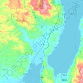
Name: 江城镇 topographic map, elevation, terrain.
Location: 江城镇, 江川区, 玉溪市, 云南省, 中国 (24.34335 102.69124 24.52055 102.89549)
Average elevation: 1,901 m
Minimum elevation: 1,718 m
Maximum elevation: 2,637 m
Other topographic maps
Click on a map to view its topography, its elevation and its terrain.