
台儿庄区 topographic map
Interactive map
Click on the map to display elevation.
About this map
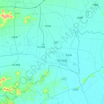
Name: 台儿庄区 topographic map, elevation, terrain.
Location: 台儿庄区, 枣庄市, 山东省, 中国 (34.46237 117.39703 34.71704 117.79350)
Average elevation: 41 m
Minimum elevation: 20 m
Maximum elevation: 322 m
Other topographic maps
Click on a map to view its topography, its elevation and its terrain.