
松溪县 topographic map
Interactive map
Click on the map to display elevation.
About this map
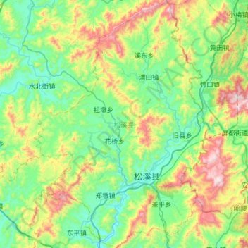
Name: 松溪县 topographic map, elevation, terrain.
Location: 松溪县, 南平市, 福建省, 中国 (27.39866 118.55180 27.85015 118.91270)
Average elevation: 480 m
Minimum elevation: 164 m
Maximum elevation: 1,367 m
Other topographic maps
Click on a map to view its topography, its elevation and its terrain.