
来舟镇 topographic map
Interactive map
Click on the map to display elevation.
About this map
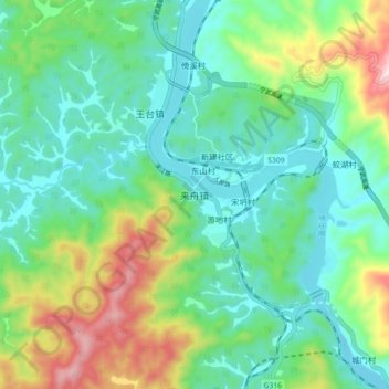
Name: 来舟镇 topographic map, elevation, terrain.
Location: 来舟镇, 南平市, 福建省, 中国 (26.58299 117.93940 26.66299 118.01940)
Average elevation: 218 m
Minimum elevation: 74 m
Maximum elevation: 590 m
Other topographic maps
Click on a map to view its topography, its elevation and its terrain.