
天烛峰 topographic map
Interactive map
Click on the map to display elevation.
About this map
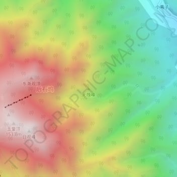
Name: 天烛峰 topographic map, elevation, terrain.
Location: 天烛峰, 泰安市, 山东省, 271000, 中国 (36.26224 117.11670 36.26234 117.11680)
Average elevation: 956 m
Minimum elevation: 418 m
Maximum elevation: 1,529 m
Other topographic maps
Click on a map to view its topography, its elevation and its terrain.