
新都桥镇 topographic map
Interactive map
Click on the map to display elevation.
About this map
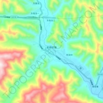
Name: 新都桥镇 topographic map, elevation, terrain.
Location: 新都桥镇, 康定市, 甘孜藏族自治州, 四川省, 中国 (30.00526 101.45277 30.08526 101.53277)
Average elevation: 3,693 m
Minimum elevation: 3,431 m
Maximum elevation: 4,241 m
Other topographic maps
Click on a map to view its topography, its elevation and its terrain.