
白湾乡 topographic map
Interactive map
Click on the map to display elevation.
About this map
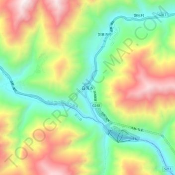
Name: 白湾乡 topographic map, elevation, terrain.
Location: 白湾乡, 马尔康市, 阿坝藏族羌族自治州, 四川省, 中国 (31.77534 101.86532 31.85534 101.94532)
Average elevation: 2,984 m
Minimum elevation: 2,239 m
Maximum elevation: 4,106 m
Other topographic maps
Click on a map to view its topography, its elevation and its terrain.