

Make a donation
Nevada topographic maps
Click on a map to view its topography, its elevation and its terrain.
Lake Mead
United States > Nevada > Clark County
At maximum capacity, Lake Mead is 112 miles (180 km) long, 532 feet (162 m) at its greatest depth, has a surface elevation of 1,221.4 feet (372.3 m) above sea level and 247 square miles (640 km2) of surface area, and contains 26.12 million acre feet (3.222×10¹³ L) of water.
Average elevation: 684 m
Make a donation
Make a donation
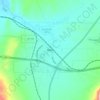
Wells
United States > Nevada > Elko County
According to the United States Census Bureau, the city has a total area of 6.9 square miles (18 km2), all land, at an elevation of 5,630 feet (1,720 m).
Average elevation: 1,744 m
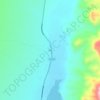
Hiko
United States > Nevada > Lincoln County
The Hiko and Crystal Springs provide a large supply of water for the Hiko farms and ranches. The Hiko farming community is located in the north end of the Pahranagat Valley and lies at an elevation of 3,869 feet (1,179 m), with a ZIP code of 89017.
Average elevation: 1,233 m
Make a donation

Make a donation
Valley of Fire State Park
Valley of Fire is located 50 miles (80 km) northeast of Las Vegas, at an elevation between 1,320–3,009 feet (402–917 m). It abuts the Lake Mead National Recreation Area on the east at the Virgin River confluence. It lies in a 4 by 6 mi (6.4 by 9.7 km) basin.
Average elevation: 614 m
Make a donation
Make a donation

Make a donation
Make a donation
Yerington
United States > Nevada > Lyon County
During the summer, temperatures are generally hot to very hot in the afternoon, but the high altitude and low humidity means temperature drop to a comfortable level at night. On average, 8.0 afternoons each summer will exceed 100 °F or 37.8 °C and 73.2 afternoons reach 90 °F (32.2 °C). It is rare, though,…
Average elevation: 1,358 m
Make a donation
Make a donation
Mound House
United States > Nevada > Lyon County
Mound House is a small unincorporated community in Lyon County, Nevada on U.S. Route 50 that is situated between Nevada's capital, Carson City, and Dayton. Its elevation is 4,974 feet (1,516 m). It is in Lyon County, one of eight Nevada counties that allow for legalized prostitution, and is home to four…
Average elevation: 1,521 m
Make a donation
Make a donation
Make a donation
Make a donation
Searchlight
United States > Nevada > Clark County
Searchlight is an unincorporated town and census-designated place (CDP) in Clark County, Nevada, United States, at the topographic saddle between two mountain ranges. At the 2020 census it had a population of 445.
Average elevation: 1,087 m
Ruby Mountains
United States > Nevada > Elko County
The Ruby Mountains (Shoshoni: 'Duka Doya', meaning “Snowcapped”) are a mountain range, primarily located within Elko County with a small extension into White Pine County, in Nevada, United States. Most of the range is included within the Humboldt-Toiyabe National Forest. The range reaches a maximum…
Average elevation: 1,962 m
Make a donation
Winnemucca
United States > Nevada > Humboldt County > Winnemucca > Winnemucca
Average elevation: 1,403 m
Make a donation

Make a donation

Make a donation
Make a donation

Great Basin
United States > Nevada > Eureka County
The Great Basin is the largest area of contiguous endorheic watersheds, those with no outlets, in North America. It spans nearly all of Nevada, much of Utah, and portions of California, Idaho, Oregon, Wyoming, and Baja California. It is noted for both its arid climate and the basin and range topography that…
Average elevation: 1,918 m
Make a donation
Make a donation
Make a donation
Make a donation
Angel Lake
United States > Nevada > Elko County
Angel Lake is a glacial tarn in the northern part of the East Humboldt Range, in central Elko County in the northeastern part of the state of Nevada. It is located at approximately 41°01.6′N 115°05.1′W / 41.0267°N 115.0850°W / 41.0267; -115.0850, and at an elevation of 8378 feet (2553 m). It…
Average elevation: 2,672 m
Make a donation
Sand Harbor
United States > Nevada > Washoe County > Incline Village-Crystal Bay
Average elevation: 2,006 m
Make a donation