
Sparks topographic map
Interactive map
Click on the map to display elevation.
About this map
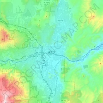
Name: Sparks topographic map, elevation, terrain.
Location: Sparks, Washoe County, Nevada, 89431-5025, United States (39.38047 -119.90872 39.70047 -119.58872)
Average elevation: 1,636 m
Minimum elevation: 1,300 m
Maximum elevation: 3,108 m