
柳埠街道 topographic map
Interactive map
Click on the map to display elevation.
About this map
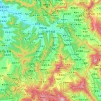
Name: 柳埠街道 topographic map, elevation, terrain.
Location: 柳埠街道, 南部山区, 历城区, 济南市, 山东省, 250100, 中国 (36.33485 117.04302 36.47900 117.23195)
Average elevation: 412 m
Minimum elevation: 136 m
Maximum elevation: 923 m
Other topographic maps
Click on a map to view its topography, its elevation and its terrain.