
土黄镇 topographic map
Interactive map
Click on the map to display elevation.
About this map
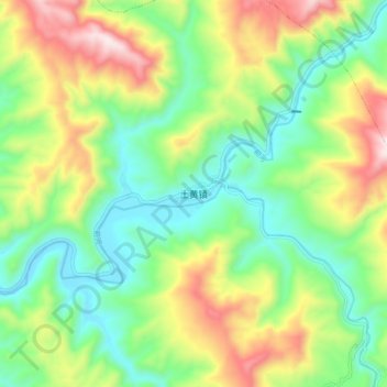
Name: 土黄镇 topographic map, elevation, terrain.
Location: 土黄镇, 宣汉县, 达州市, 四川省, 中国 (31.54734 108.14842 31.62734 108.22842)
Average elevation: 664 m
Minimum elevation: 403 m
Maximum elevation: 1,120 m
Other topographic maps
Click on a map to view its topography, its elevation and its terrain.