
桃花镇 topographic map
Interactive map
Click on the map to display elevation.
About this map
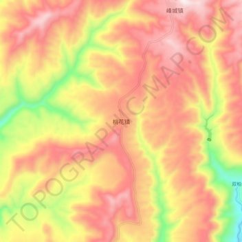
Name: 桃花镇 topographic map, elevation, terrain.
Location: 桃花镇, 宣汉县, 达州市, 四川省, 中国 (31.44183 107.91116 31.52183 107.99116)
Average elevation: 924 m
Minimum elevation: 457 m
Maximum elevation: 1,240 m
Other topographic maps
Click on a map to view its topography, its elevation and its terrain.