
土城藏族乡 topographic map
Interactive map
Click on the map to display elevation.
About this map
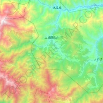
Name: 土城藏族乡 topographic map, elevation, terrain.
Location: 土城藏族乡, 平武县, 绵阳市, 四川省, 中国 (32.31322 104.02166 32.47824 104.29406)
Average elevation: 2,055 m
Minimum elevation: 1,039 m
Maximum elevation: 4,077 m
Other topographic maps
Click on a map to view its topography, its elevation and its terrain.