
黄羊关藏族乡 topographic map
Interactive map
Click on the map to display elevation.
About this map
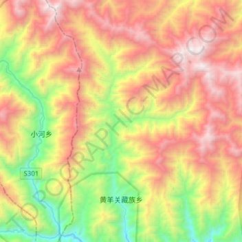
Name: 黄羊关藏族乡 topographic map, elevation, terrain.
Location: 黄羊关藏族乡, 平武县, 绵阳市, 四川省, 中国 (32.50916 104.15206 32.72190 104.31806)
Average elevation: 2,562 m
Minimum elevation: 1,204 m
Maximum elevation: 4,125 m
Other topographic maps
Click on a map to view its topography, its elevation and its terrain.